Maps of the Área Silvestre Protegido (ASP or Protected Wildlands) of Área de Conservación Guanacaste (ACG), including a map of different ASP management Sectors, a map of major ecosystems, and a contour map. Many more maps can be found in the visual menu of the map section of the ACG website, and GIS layers can also be downloaded (text in Spanish).
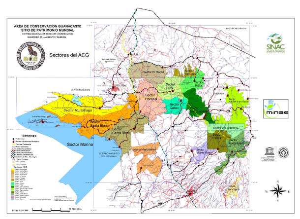
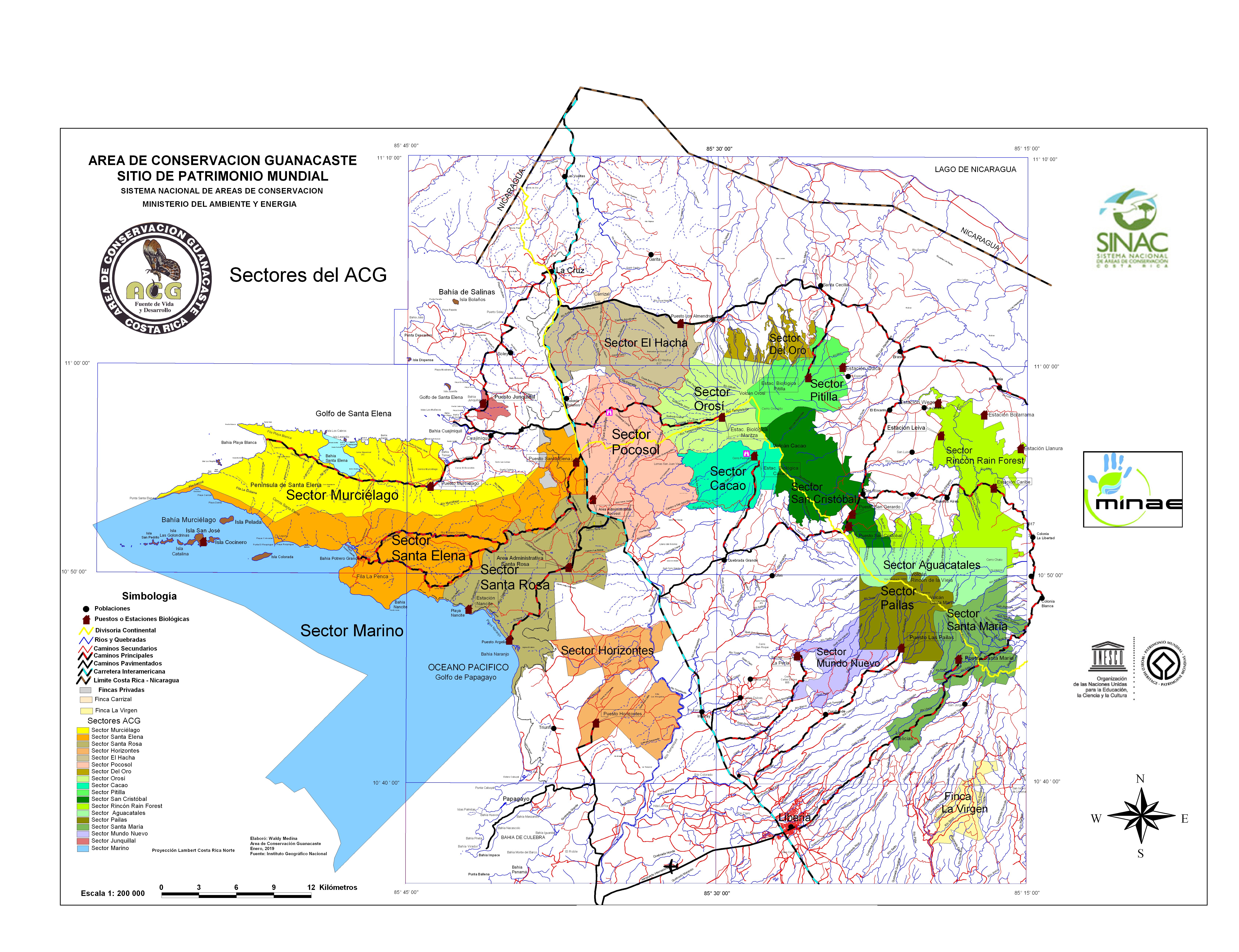
ACG Sector Map This map shows the total area of the 169,000 hectare (> 415,000 acres) ASP of Área de Conservación Guancaste (ACG) containing 18 different management sectors, which cover what was three national parks, a forest reserve, two wildlife refuges, a marine sanctuary, a forest experiment station, and three private GDFCF sectors (1, 2, 3 in map). This map also shows the location of biological research stations staffed by ACG- and GDFCF-supported parataxonomists. Full size JPG, 4.2MB
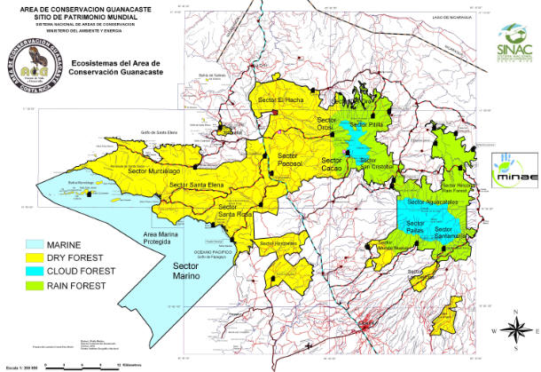
ACG Ecosystem Map This map shows the location of the four major ecosystems of the ASP of Área de Conservación Guanacaste: Marine, Dry forest (yellow), Rain Forest (green), and Cloud Forest (blue). Full size JPG, 4.0MB
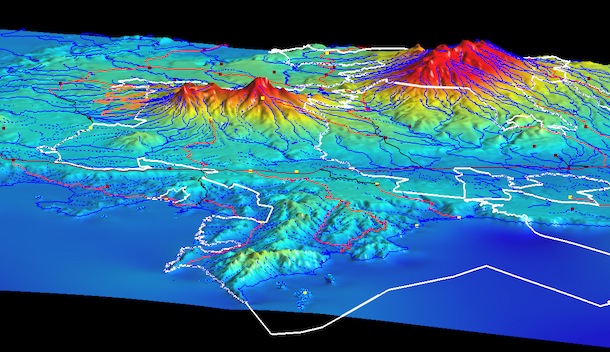
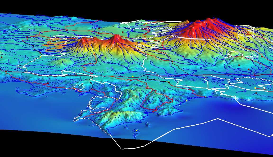
ACG 3D Contour Map This 3D model map outlines with a white border (orange for Sector Del Oro) the ASP of Área de Conservación Guanacaste, from Sector Marino on the Pacific to the rain forested Sector Pitilla, Sector San Cristobal and Sector Rincón Rain Forest on the Caribbean side of Costa Rica. Each yellow square is a biological station and the ACG Area Administrativa is at the Pacific end of the black road dropping SW from the Interamerican Highway running horizontally through the map. Liberia is out of sight to the right and La Cruz is out of sight to the left. Lake Nicaragua is in the black void in the upper left corner. Full size JPG, 1.0 MB